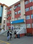
Komut Street, 20A

Komut Street, 20A, Karargahtepe Neighborhood, Kecioren District, Ankara Province
Coordinates:
39.969599, 32.859870
clipboard
Save
Overview
Businesses inside
Show entrances

Search nearby

Restaurants
Pharmacies
Groceries
ATMs
Housewares
Hotels
Shopping malls
Cafes
Museums
Gas stations
Add an item
Edit information

Directions

Meteoroloji
760 m
2
MeteorolojiBelediyeDışkapı
Bekir Gökdağ Lisesi
239 m
4
Bekir Gökdağ LisesiMeteorolojiKütükçü Ali BeySelçuklu Cd.Eşref Bitlis Parkı
Show parking info

Businesses in the building

  • Turkish Health Workers Union Primary School
    Photos
    Turkish Health Workers Union Primary School (Ankara Province, Kecioren District, Karargahtepe Neighborhood, Gulal Street, 8), primary school
    10
    Turkish Health Workers Union Primary School
    Closed until tomorrow
    Primary school
    Ankara Province, Kecioren District, Karargahtepe Neighborhood, Gulal Street, 8
  • Turkish Health Workers Union Secondary School
    Photos
    Turkish Health Workers Union Secondary School (Ankara Province, Kecioren District, Karargahtepe Neighborhood, Komut Street, 19), school
    2
    Turkish Health Workers Union Secondary School
    Closed until tomorrow
    School
    Ankara Province, Kecioren District, Karargahtepe Neighborhood, Komut Street, 19
  • Maps • Ankara • Kecioren
    Report an error
    Services
    Personal
    For business
    Yandex Maps: find where to eat, what to see, and how to have fun
    © 2001–2025 Yandex LLC
    Help
    About
    User agreement