Add an item
Zerafet Street, 7
Zerafet Street, 7, Necip Fazil Neighborhood, Umraniye, Istanbul
Coordinates:
clipboard
Search nearby
Directions
Necip Fazıl
289 m
Necip Fazıl Metro
177 m
Businesses in the building
Umraniye Public Education Center and Evening Art School

Umraniye Public Education Center and Evening Art School
Closed until tomorrow
Istanbul Umraniye No. 20 Family Health Center
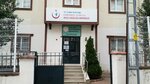
Istanbul Umraniye No. 20 Family Health Center
Closed until tomorrow