Göynük Canyon

Address
Contacts
+90 850 307 33 03
Show phone
Business hours
Closed until tomorrow
Directions
Similar places nearby
314 reviews
May 6
A beautiful natural landmark.
Definitely worth a visit.
Admission is 5€ (€ is accepted, it is not necessary to change to lira).
Very polite staff.
You can get from the center of Kemer on your own by bus TA08, from the shopping area to the center of the Goynuk 50TL district.
You can walk further.
Bring flip-flops and swimsuits, trekking sneakers and panama hats, and a snack.
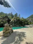
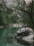
There are places allowed for swimming in the Canyon, there are places where it is forbidden, good trails for walking in the mountains, there is a suspension bridge, paths along the river through the forest against the current. In general, it's a good place.
You can walk all day.
From entertainment: Zip-line, Rafting, small trekking.
See original · Русский
2
January 16
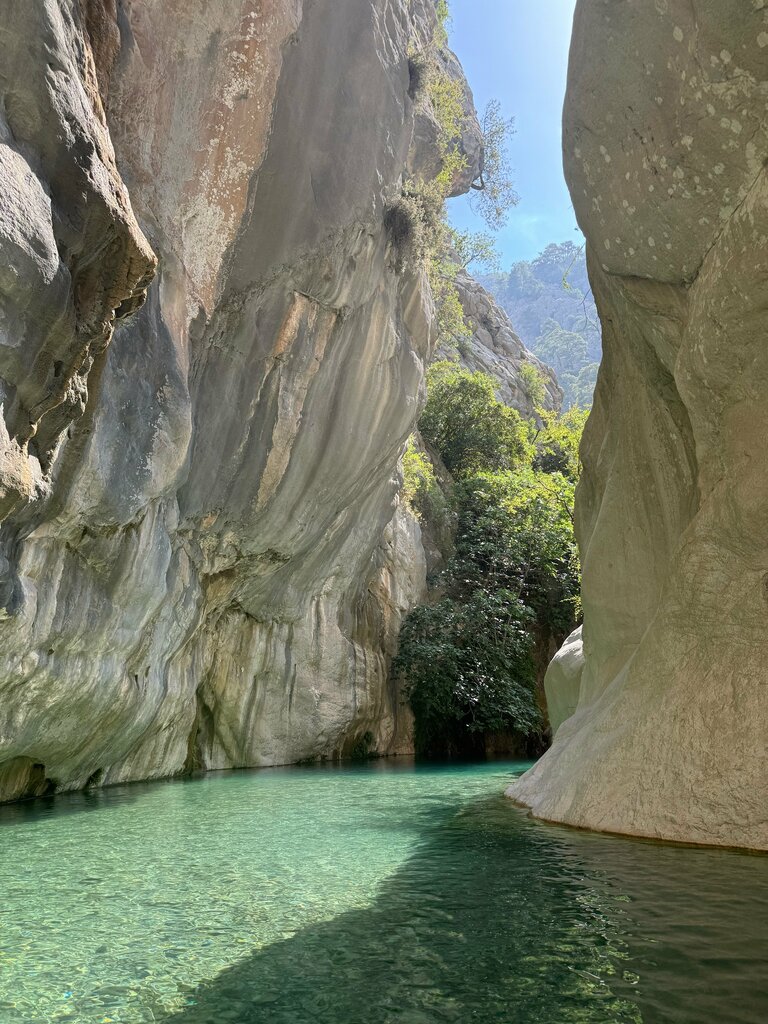
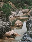
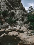
I liked this canyon more than Saklikent. The canyon is located 9 kilometers from Kemer in southern Turkey.
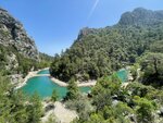
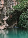
The canyon itself is a gorge about 6 meters wide (sometimes more, sometimes less) and up to 350 meters high. Numerous waterfalls fall from the walls, the water is a rich blue color, and pine trees grow on the banks of the river in its wide part.
From the entrance to the park to the canyon, you need to walk about 3 kilometers in one direction, climbing in height, about 150 meters. The trail is uncomplicated, the road is unpaved. By the way, for those who don't want to go, if the wagon goes straight to the canyon. But I advise, of course, to walk. There are great views along the way.
Do not miss the suspension bridge on the way to the canyon. Somewhere in the middle of the road, before approaching a steeper rise, there is a bridge on the right. After crossing it, there is a forest path that also leads to the exit. For a fee, you can do "canyoning" — walking along a river flowing in a canyon with alternating sections of wide water and ford.
The path runs along the river in the narrowest parts of the canyon. In some places, you can reach the walls with your arms outstretched.
See original · Русский
4
February 19
A super beautiful place at any time of the year. We were in February. There is also a part of the Lycian trail. Pros: there are practically no tourists. Relative cons: almost nothing works. You can get water, but you can't eat or have any additional entertainment. And it seems that one of the ziplines is working, at the very beginning of the journey. Rafting also does not work in winter (which is logical in principle). The shuttle service to the canyon and back does not work - with children and those with health problems, it's too hard to climb 2 km uphill. There is also a "stand-up" for those who are afraid of heights. There are two starting points from the first site: a wide road on the left, along which there is a jeep transfer during the season. On the right is the tropic along the canyon and the signs just lead there. The whole setup is that about a third of the way the path stops at a suspension bridge over a precipice and then either overcome yourself and cross, or return and start walking along a wide road.
See original · Русский